Discover Narragansett, RI
Narragansett is a beach resort town 30 miles south of Providence, RI. Visitors looking for fun outdoor activities and a relaxing beach getaway will find it here in Narragansett, Rhode Island.
Visitors are encouraged to pick up a free destination guide from the local visitors center or tourism information center. Local guides include accommodations, attractions, water activities, events & festivals, and popular restaurants.
![]()
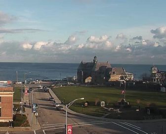
Live Webcams
View live webcams from Narragansett, Rhode Island. Check the current weather conditions, beach activity, and enjoy spectacular sunsets and sunsets. It’s not quite the same as being here but it’s a great way to daydream from far away!
![]()
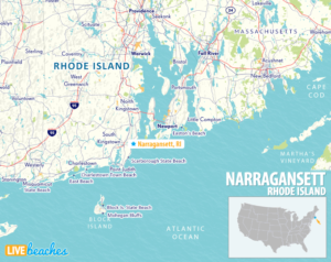
Map of Narragansett & Nearby Beaches
Use the map as a guide to find the best beaches in Rhode Island and locate nearby cities and points of interest.
• Narragansett, RI Map
• Map of Beaches in Rhode Island
![]()
Narragansett, RI Average Temperatures
Wondering the average monthly temperatures in Narragansett, RI? Use this chart below to view the average daily high and low air temperatures including the average ocean temperature per month.
• Average High Temperatures per Month
• Average Low Temperatures per Month
• Average Ocean Temperatures
Narragansett, Rhode Island Average Temperatures
Use this weather chart as a guide to view the average air and ocean temperatures in Narragansett, RI.
The average air temperature in the summer varies between 75-80 degrees.
The average ocean temperature in the summer varies between 60-70 degrees.
Average Monthly Temperatures
| Average High | Average Low | Average Ocean Temp | |
|---|---|---|---|
| January | 38 | 23 | 37 |
| February | 40 | 25 | 36 |
| March | 46 | 31 | 37 |
| April | 55 | 40 | 47 |
| May | 64 | 48 | 56 |
| June | 73 | 58 | 62 |
| July | 79 | 64 | 68 |
| August | 78 | 64 | 70 |
| September | 73 | 59 | 67 |
| October | 62 | 48 | 60 |
| November | 53 | 39 | 52 |
| December | 44 | 29 | 44 |
Average high, low and ocean temperatures in Narragansett. Sources: Accuweather, Weather.com, NOAA Climate.gov.


